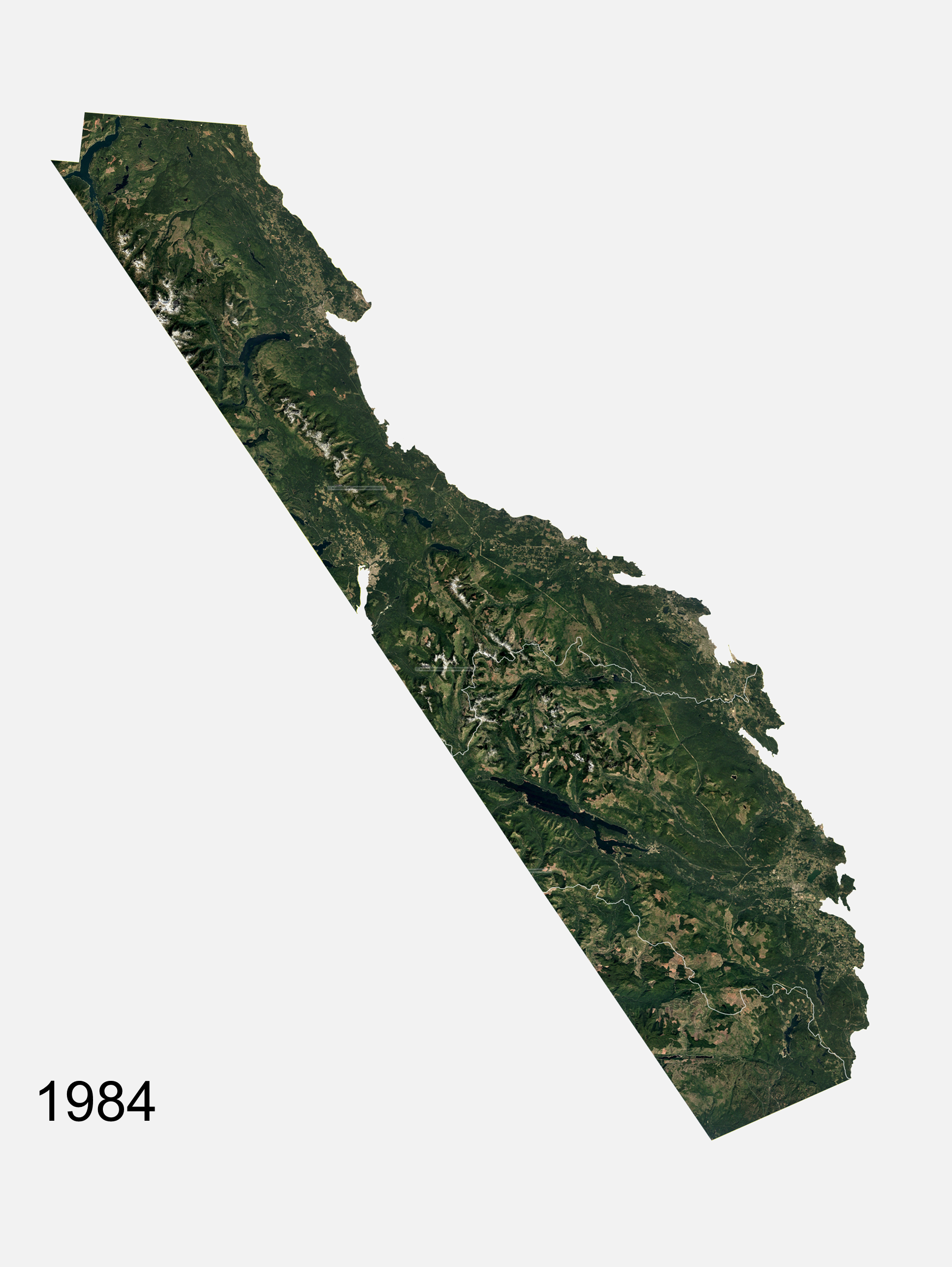
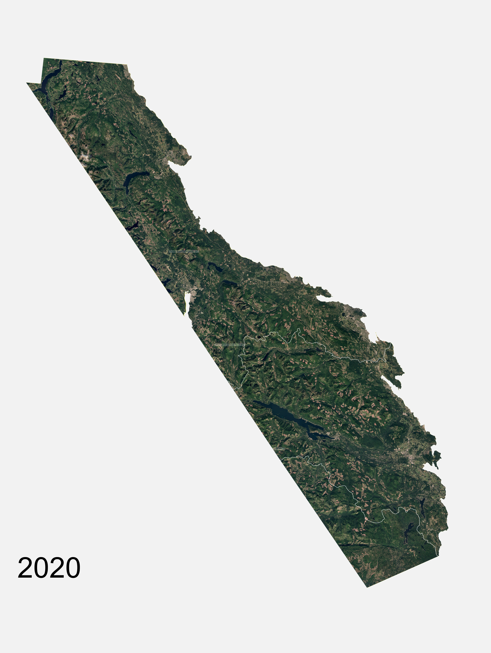
Timelapse of E&N Land Grant
SOURCE: Google Earth
A 40-year timelapse of composite Google Earth imagery showing timber harvesting on lands within the E&N Land Grant, including HTG territory (demarcated in white lines at the southern end of the E&N Land Grant)
Composite stills from 1984 and 2020 demonstrate the expansion of timber harvesting northward and a shift toward many, small cutblocks rather than few, large cutblocks.
To view finer-scale timelapses, play the videos below. Each video shows a timelapse of one of five zones within the E&N Land Grant, roughly demarcated by latitude.
Zone 1
The northernmost area of the E&N Land Grant, roughly spanning the area from Campbell River to Union Bay.
Zone 2
The second northernmost area of the E&N Land Grant, roughly spanning Courtenay to Qualicum Beach.
Zone 3
The central area of the E&N Land Grant, roughly spanning Qualicum Beach to Cedar. This zone overlaps with HTG territory.
Zone 4
The second southernmost area of the E&N Land Grant, roughly spanning Ladysmith to Cowichan Bay. This zone overlaps with HTG territory.
Zone 5
The southernmost area of the E&N Land Grant, roughly spanning Maply Bay to Shirley. This zone overlaps with HTG territory.