Quwutsun
The following materials show changes to the land around Quwutsun, one of the places where the First Ancestors fell.

“Syalutsa’ was the first ancestor to fall from the sky. He fell to the warm ground of Quwutsun near present-day Koksilah Ridge…”
“In Coast Salish culture, oral traditions about The First Ancestors of local communities provide some of the basic cultural material by which people develop and express their relationship to the land and each other – in a sense, their legal tradition. Through these stories, ancestors are associated with and embodied in the land. The telling of these stories, along with the experience of these beings at these places, brings the legendary people to life. In essence, these places become these ancestors: they serve as ‘living’ legal scholars. They are places where the Hul’qumi’num legal tradition can be ‘applied, studied, perfected and taught.’”
Sarah Morales, “Snuw’uyulh: Fostering an Understanding of the Hul’qumi’num Legal Tradition” (2014) University of Victoria, PhD Dissertation at p. 42.

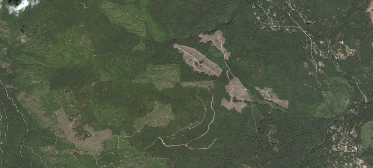
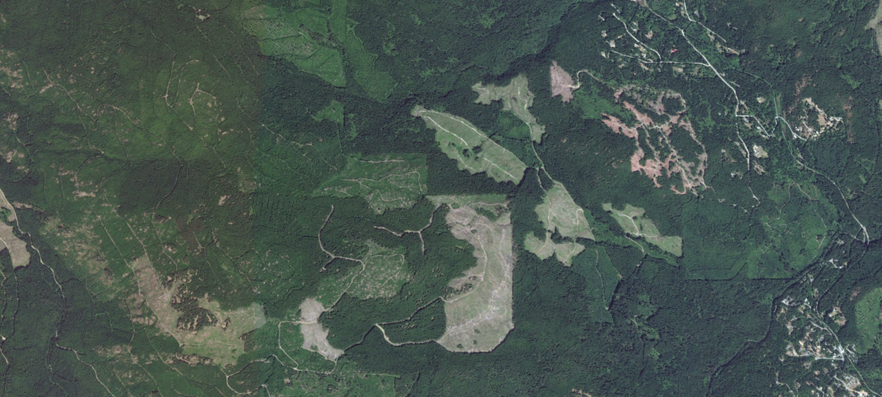
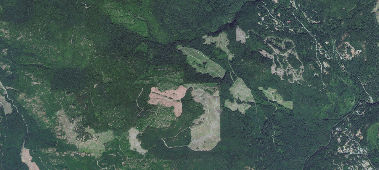

40 Years of Landscape Change around Quwutsun
Quwutsun - also referred to as Koksilah Ridge - is a site of both commercial logging and extensive recreational use.
Landscape-level change near Quwutsun is visible through satellite imagery. The carousel above shows logging in the vicinity of Quwutsun in September 2004, July 2013, July 2016, August 2017, and July 2022. The video below shows a timelapse of Quwutsun from 1984 to 2020
Access Networks Near Quwutsun
The map above shows a preliminary sketch of access networks in the vicinity of Quwutsun. The blue represents water, the yellow represents footways/cycleways, the thick orange lines are public roadways, and the thin orange lines are roadways that are believed to be restricted.
In an area of 34.9 square km around Quwutsun, we found approximately:
-
114.58 KM
ROADWAYS
The total length of public and private roadways was approximately 114.58 km, for a combined road density of 3.28 km/square km.
-
20.22 KM
FOOTWAYS/CYCLEWAYS
In addition to roads, we found approximately 20.22 km of footways and roadways, clustered near the Renfrew Road Bridge.
-
50.08%
OF ROADWAYS RESTRICTED
Of the 114.58 km of total roadways, we found that approximately 56.37 km were public and the remaining 58.21 km were restricted.